Reconstruction of past terrestrial climate and ecosystem response relies on archives that incorporate and preserve information about changes in temperature, precipitation, nutrients, vegetation, fire history, etc.
The resolution and length of such paleoclimate/ecological records is dependent on the type of archive. Although much information is able to be determined from dendrochronological and related studies, the range and application of tree-ring records can be limited. Lakes, ponds, bogs, and other soil/sediment accreting deposits are used to expand the geographical range and time span of reconstructions of past climate and ecosystem dynamics. Such studies commonly used sediment cores on which a plethora of analyses can be made including but not limited to: physical (grain size, paleomagnetics, susceptibility), chemical (concentration, isotopic), and mineralological properties, flora (eg., macrofossils, pollen, spores), fauna (ostracods, molluscs, insectivore) to name a few.
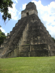
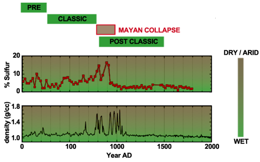
In this example of reconstructing past precipitation and environment from the low lands of meso America, when the lake level decreases the concentration of sulfur increases to the point that gypsum will precipitate. Initially, and based on cores from the periphery of a series of lakes in the Tikal district of Guatemala and the Yucatan it appeared that there was one, large, continuous 200-300 year drought that was coincident with the end of the Mayan Classic Period. Subsequent cores from deeper parts of the lakes exhibit intercalated gypsum mud implying several multi-decadal droughts instead of one large multi-centennial megadrought.


